
Beinn Eisgein [Ben Eishken]
Good walks are even better shared.
Overview
Beinn Eisgein [Ben Eishken]
Nestled in the breathtaking Scottish Highlands, Beinn Eisgein stands tall at an impressive 706 meters. Known as a Marilyn, this mountain offers a plethora of challenges and a stunning landscape that leaves any hiker in awe.
Geology
The mountain is primarily made up of ancient gneiss, a metamorphic rock over a billion years old. It's incredible to think that as you climb, you're stepping on rocks that have seen the dawn of time itself! This terrain gives rise to a unique ecosystem that thrives in these rugged conditions.
Routes
Corran Esuird Track
For those looking for a scenic yet moderate trek, the Corran Esuird Track is ideal. This 8.5km route starts from a small car park and meanders through beautiful heather and grassy patches, making it a lovely walk to enjoy the highlands' flora.
Direct Ascent from A87
If you're feeling particularly adventurous and up for a challenge, consider the direct ascent from the A87 road. This 5.5km trek involves steeper slopes and rocky paths, rewarding those who dare with sublime views at the summit.
Summit Features
At the top of Beinn Eisgein, you'll encounter a substantial stone cairn – a testament to the many adventurers who’ve stood where you will. It’s a perfect spot for that well-deserved rest and a cup of tea.
Terrain Type
The terrain itself is a mix of rocky paths, grassy slopes, and a few boggy areas that might surprise the unwary. Footwear with good grip is advisable!
Views
One of the most rewarding aspects of hiking Beinn Eisgein is the views. On a clear day, the sights of Skye’s rugged landscapes, including the notorious Skye Cuillins and Loch Slapin, are nothing short of breathtaking. Late spring through early autumn is the best time to soak in these panoramic vistas.
Hazards
Always keep an eye on the skies! Weather can change quickly in the Highlands, and some patches can be slippery. Navigating rocky terrain requires a good sense of balance, so tread carefully!
Nearby Summits
Beinn Eisgein is surrounded by other notable peaks, including Beinn Bheag and Garrabeg, both providing excellent opportunities for extended hikes in this stunning area.
Access
Parking is available at Corran, and while public transport is a bit sparse, Broadford, the nearest town, offers amenities that can be quite handy before or after your hike.
Facilities
The nearest facilities can be found in Broadford, where you can indulge in some cafes or shops to replenish your energy post-hike.
History
Etymologically speaking, Beinn Eisgein means 'Mountain of the Ashes'. As such, it may well evoke tales of history, perhaps of ancient fires or conflicts etched into the very rocks themselves.
Undoubtedly, Beinn Eisgein is a marvelous destination for hikers seeking beauty, adventure, and a touch of historical intrigue. Grab your gear and take on the challenge – the Highlands await!
Explore routes near Beinn Eisgein [Ben Eishken]
Public walks starting within 80 km of this hill. Nearby does not mean a route reaches the summit; check its map and access before setting out.
Beautiful private beach walk Isle of Harris
View route
Berneray Community Hall to the beautiful beach
View route
Fairy Lochs Liberator Wreckage Circuit
View route
Route planning notes
These notes describe possible approaches, not verified navigable routes or permission to cross land. Check current paths, local access rules and conditions before setting out.
Corran Esuird Track
A scenic approach starting from the car park at Corran, following a well-trodden path that gradually ascends through heather and grass.
Direct Ascent from A87
A more challenging route that involves a steeper ascent directly from the A87 road, suitable for seasoned hikers.
Make a day of it, together
Find someone to share the walk with, or organise a day out along a route you like.
Hill facts and local notes
Classifications
Elevation
129m
423 ft
Prominence
103m
Coordinates
58.0192, -6.5114
NB336122
OS Map
13 14
Explorer: 457
At the Summit
The summit is marked by a substantial stone cairn, providing a perfect spot for a celebratory cup of tea or simply catching your breath while admiring the views.
Terrain & Geology
Primarily composed of metamorphic rocks, specifically gneiss, which are over a billion years old. This ancient geology contributes to the mountain's rugged beauty and unique biodiversity.
Views & Scenery
From the summit, enjoy breathtaking panoramic views of the surrounding mountains, including the rugged peaks of the Skye Cuillins and the shimmering waters of Loch Slapin.
History & Heritage
Name Origin
Beinn Eisgein translates to 'Mountain of the Ashes', suggesting a storied past that perhaps hints at ancient fires or battles.
Historical Significance
The mountain is a hidden gem for hikers in Skye and offers a place of tranquility and reflection amidst the stunning Highland landscapes.
Getting There & Facilities
Check current local access restrictions, parking rules and transport timetables before travelling. These notes do not confirm public access to the summit.
Parking
There's a small parking area at Corran, just off the A87, which can accommodate a few cars.
Public Transport
The nearest bus service is limited, but local transport options may be available from Broadford during the summer months.
Nearby Facilities
While there are no facilities on the mountain itself, Broadford offers several cafes, shops, and restrooms for post-hike refreshments.
Safety Information
Known Hazards
- Underfoot conditions can vary significantly, so be prepared for rocky and slippery patches, especially after rain. Keep an eye on weather changes, as conditions can deteriorate quickly in the Highlands.
General Safety Tips
- Check weather conditions before setting out
- Carry appropriate clothing and equipment
- Let someone know your planned route
- Take a map, compass, and GPS device
- Carry emergency supplies: food, water, first aid kit, torch
Hills
Some common questions about the hills answered
Are there group walks up Beinn Eisgein [Ben Eishken]?
Many walkers use Walkmates to join or organise walks with others. You can check for group walks around Beinn Eisgein [Ben Eishken] through the maps
Are there other walkers around Beinn Eisgein [Ben Eishken]?
Activity varies by location and time, but Walkmates lets you see whether others have shared walks or shown interest in this area. Find other people through the walking friends search walking friends for Beinn Eisgein [Ben Eishken] search or of course create your own walk for Beinn Eisgein [Ben Eishken]
Can I organise a walk to Beinn Eisgein [Ben Eishken]?
Yes. If there aren’t any walks listed already, you can create a walk and make it available for others to join.
If you're signed up to Walkmates, you can create a walk to Beinn Eisgein [Ben Eishken].
How do I find a walk up this hill?
There are often multiple ways to walk this hill, depending on experience and route preference. Walkmates helps you explore walks and routes that others have shared.
Can I suggest a new route up Beinn Eisgein [Ben Eishken]?
Yes. You can suggest or create routes to share with others. Walkmates focuses on the social side of walking, so routes are used to help people organise walks and explore areas together, rather than as detailed navigation tools or route libraries.
Other uses really appreciate knowledgeable walkers sharing their routes. Share your favourite route to Beinn Eisgein [Ben Eishken] here
The is an error or something incorrect about this hill. How do I let you know?
We always strive to keep the information on Walkmates as accurate as possible. If you find an error, please let us know through the contact form and we'll aim to correct it as quickly as possible
Community Discussion
Comments
Location
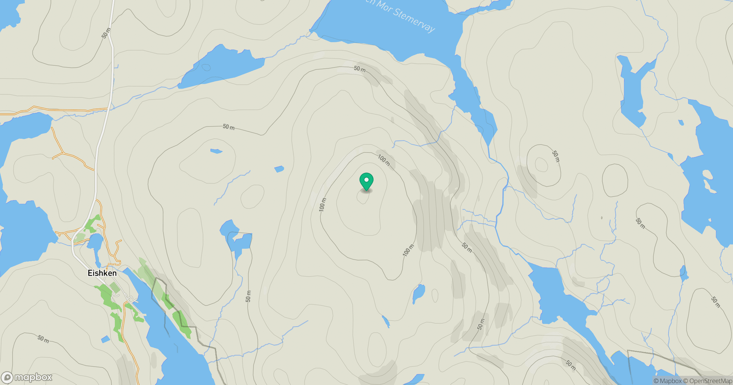
Grid reference: NB336122
View on OpenStreetMapOpens a map in a new tab, centred on the hill.
Hills within 30 km
Straight-line distance, not a walking route or confirmation of access.
An Cliseam [Clisham]
800m
Feiriosbhal [Feirihisval]
327m
Mullach Breac Mhalasgair
172m
Beinn Bhreac
191m
Guaineamol
405m
No comments yet. Be the first.